Prospect evaluation
Streamline projects while maintaining decision integrity.
When an oil exploration opportunity emerges, quickly access essential data for accurate prospect evaluation. Use maps and analysis to realize the full potential of land holdings. During upstream production, real-time situational awareness strengthens performance.
CASE STUDY
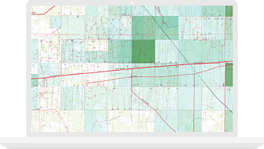
Whiting’s One Call department is responsible for identifying and protecting underground assets at thousands of well sites and field locations. Accuracy in identifying those hidden assets is critical to the company’s success, to prevent costly errors and safety hazards. Using ArcGIS and the Argis Framework, the organization is able to visualize risk areas on-site, reducing analysis time and saving money.
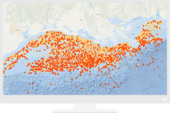
Ready-to-use maps give more context to exploration and production workflows.
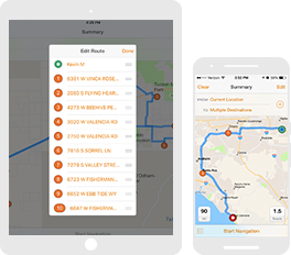
Improve operational efficiencies in field workforce activities.
Use real-time mapping and spatial analysis to provide situational awareness for dynamically changing assets.

Esri User Conference
Notify me when there is a new event
Esri partners offer specialized solutions built on ArcGIS to solve your real-world challenges.